 vesseltracker.com
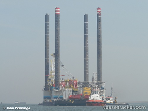
 Jb117
Jb117
Current Status
Where is the vessel?
Jb117 is currently in 22 nm N of Town Quays/Drogheda, based on AIS data received less than 1h ago.
Latest AIS update:
Current position: 54.06712° N, 6.17365° E (22 nm N of Town Quays/Drogheda)
Average speed (last 7 days): Loading…
Average speed (last 30 days): Loading…
Vessel profile: Jb117 is a [service_ship.crane_barge] with dimensions 75m x 40m.
This page combines live AIS, route history, probable destination signals, nearby traffic, and port activity for practical vessel monitoring.
The current position of vessel Jb117 is 54.06712 lat / 6.17365 lng. Updated: 2026-04-28 02:23:36 UTCNearest reference points:
- 14 nm NW of Town Quays/Drogheda
- Near Borkum
- Near Hoogkerk
Currently sailing under the flag of Bahamas ![]()
Jb117 built in 2011 year
Deadweight:
2512 tDetails:
Live Vessel Jb117 Analytics (details, animations, etc.)
Recent AIS points (UTC):
2026-04-27 22:50:33 UTC · 54.06710, 6.17371 · SOG 0 kn · COG 132°2026-04-27 23:38:40 UTC · 54.06712, 6.17367 · SOG 0 kn · COG 133°
2026-04-28 01:50:36 UTC · 54.06712, 6.17363 · SOG 0 kn · COG 132°
2026-04-28 02:23:36 UTC · 54.06712, 6.17365 · SOG 0 kn · COG 132°