 vesseltracker.com
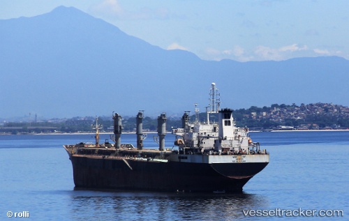
Sao Luiz
Current StatusWhere is the vessel?
Sao Luiz is currently in Near NITEROI, based on AIS data received less than 1h ago.
Latest AIS update:
Current position: 22.82063° S, 43.15249° W (Near NITEROI)
Average speed (last 7 days): Loading…
Average speed (last 30 days): Loading…
Vessel profile: Sao Luiz is a Crude Oil Tanker with dimensions 42m x 245m.
This page combines live AIS, route history, probable destination signals, nearby traffic, and port activity for practical vessel monitoring.
The current position of vessel Sao Luiz is -22.82063 lat / -43.15249 lng. Updated: 2026-05-14 17:48:50 UTCNearest reference points:
- Near NITEROI
- Near Rio De Janeiro
- Near Santos Dumont Apt/Rio de Janeiro
Details:
Live Vessel Sao Luiz Analytics (details, animations, etc.)
Recent AIS points (UTC):
2026-05-14 13:58:53 UTC · -23.02936, -43.06152 · SOG 5.4 kn · COG 296°2026-05-14 16:28:51 UTC · -22.82079, -43.15219 · SOG 0.3 kn · COG 2°
2026-05-14 16:30:12 UTC · -22.82074, -43.15231 · SOG 0.3 kn · COG 4°
2026-05-14 17:48:50 UTC · -22.82063, -43.15249 · SOG 0 kn · COG 4°