 vesseltracker.com
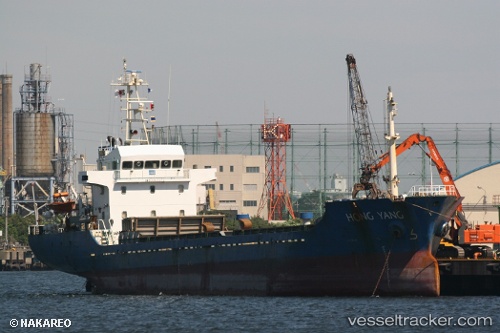
 Hong Yang
Current Status
Where is the vessel?
Hong Yang is currently in 107 nm SE of Nudao, based on AIS data received less than 1h ago.
Latest AIS update:
Current position: 34.90803° N, 122.10532° E (107 nm SE of Nudao)
Average speed (last 7 days): Loading…
Average speed (last 30 days): Loading…
Vessel profile: Hong Yang is a General Cargo Ship with dimensions 81m x 13m.
This page combines live AIS, route history, probable destination signals, nearby traffic, and port activity for practical vessel monitoring.
The current position of vessel Hong Yang is 34.90803 lat / 122.10532 lng. Updated: 2026-05-13 19:20:52 UTCNearest reference points:
- 93 nm SE of Nudao
- 116 nm NE of DAFENG
- 85 nm NE of Sanya Pt
Currently sailing under the flag of Belize ![]()
Hong Yang built in 2006 year
Deadweight:
3300 tDetails:
Live Vessel Hong Yang Analytics (details, animations, etc.)
Recent AIS points (UTC):
2026-05-13 16:17:30 UTC · 35.06582, 121.54225 · SOG 9.3 kn · COG 111°2026-05-13 16:51:03 UTC · 35.03886, 121.64242 · SOG 9 kn · COG 111°
2026-05-13 17:27:01 UTC · 35.00619, 121.75005 · SOG 9 kn · COG 110°
2026-05-13 19:20:52 UTC · 34.90803, 122.10532 · SOG 10 kn · COG 104°