 vesseltracker.com
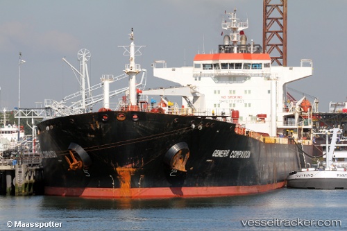
 OCEAN KOI
Current Status
Where is the vessel?
OCEAN KOI is currently in 49 nm NE of AL SUWAIQ, based on AIS data received about 6d ago.
Latest AIS update:
Current position: 24.42942° N, 58.08605° E (49 nm NE of AL SUWAIQ)
Average speed (last 7 days): Loading…
Average speed (last 30 days): Loading…
Vessel profile: OCEAN KOI is a Oil Products Tanker with dimensions m x m.
This page combines live AIS, route history, probable destination signals, nearby traffic, and port activity for practical vessel monitoring.
The current position of vessel OCEAN KOI is 24.42942 lat / 58.08605 lng. Updated: 2026-05-07 00:03:47 UTCNearest reference points:
- 58 nm S of JASK
- 42 nm SE of Offshore Fujairah
- 17 nm SE of JASK
Currently sailing under the flag of Barbados ![]()
Details:
Live Vessel OCEAN KOI Analytics (details, animations, etc.)
Recent AIS points (UTC):
2026-05-07 00:03:47 UTC · 24.42942, 58.08605 · SOG 0.9 kn · COG 318°2026-05-07 00:03:47 UTC · 24.42942, 58.08605 · SOG 0.9 kn · COG 318°
2026-05-07 00:03:47 UTC · 24.42942, 58.08605 · SOG 0.9 kn · COG 318°
2026-05-07 00:03:47 UTC · 24.42942, 58.08605 · SOG 0.9 kn · COG 318°