 vesseltracker.com
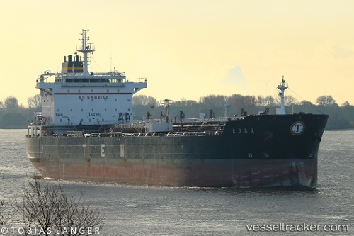
 PACKARD
Current Status
Where is the vessel?
PACKARD is currently in 20 nm NE of Scauri Alto, based on AIS data received about 1h ago.
Latest AIS update:
Current position: 37.05196° N, 12.18893° E (20 nm NE of Scauri Alto)
Average speed (last 7 days): Loading…
Average speed (last 30 days): Loading…
Vessel profile: PACKARD is a Oil/Chemical Tanker with dimensions m x m.
This page combines live AIS, route history, probable destination signals, nearby traffic, and port activity for practical vessel monitoring.
The current position of vessel PACKARD is 37.05196 lat / 12.18893 lng. Updated: 2026-05-14 05:44:26 UTCNearest reference points:
- Near MARSALA
- Near Trapani
- 13 nm N of Qulaybiyah
Currently sailing under the flag of Barbados ![]()
Details:
Live Vessel PACKARD Analytics (details, animations, etc.)
Recent AIS points (UTC):
2026-05-14 01:04:57 UTC · 36.65366, 13.18486 · SOG 11.4 kn · COG 298°2026-05-14 03:44:57 UTC · 36.88665, 12.62671 · SOG 12 kn · COG 295°
2026-05-14 04:35:25 UTC · 36.95297, 12.44091 · SOG 11.5 kn · COG 298°
2026-05-14 05:44:26 UTC · 37.05196, 12.18893 · SOG 12 kn · COG 299°