 vesseltracker.com
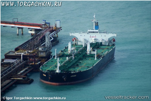
 ACHERON
Current Status
Where is the vessel?
ACHERON is currently in 21 nm NE of Verzy, based on AIS data received about 1h ago.
Latest AIS update:
Current position: 49.42800° N, 3.84440° W (21 nm NE of Verzy)
Average speed (last 7 days): Loading…
Average speed (last 30 days): Loading…
Vessel profile: ACHERON is a Crude Oil Tanker with dimensions m x m.
This page combines live AIS, route history, probable destination signals, nearby traffic, and port activity for practical vessel monitoring.
The current position of vessel ACHERON is 49.42800 lat / -3.84440 lng. Updated: 2026-05-16 03:29:33 UTCNearest reference points:
- 27 nm N of Verzy
- Near Verzy
- 12 nm S of Cornwall
Currently sailing under the flag of Barbados ![]()
Details:
Live Vessel ACHERON Analytics (details, animations, etc.)
Recent AIS points (UTC):
2026-05-15 23:36:53 UTC · 49.11917, -4.66957 · SOG 8.3 kn · COG 58°2026-05-16 01:54:53 UTC · 49.29155, -4.19988 · SOG 9.8 kn · COG 58°
2026-05-16 02:28:14 UTC · 49.33742, -4.07590 · SOG 10.1 kn · COG 56°
2026-05-16 03:29:33 UTC · 49.42800, -3.84440 · SOG 10.6 kn · COG 53°