 vesseltracker.com
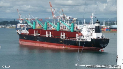
 CAPTAIN OSAMA
Current Status
Where is the vessel?
CAPTAIN OSAMA is currently in 105 nm S of Kpeme, based on AIS data received about 1h ago.
Latest AIS update:
Current position: 4.51089° N, 1.99826° E (105 nm S of Kpeme)
Average speed (last 7 days): Loading…
Average speed (last 30 days): Loading…
Vessel profile: CAPTAIN OSAMA is a Bulk Carrier with dimensions m x m.
This page combines live AIS, route history, probable destination signals, nearby traffic, and port activity for practical vessel monitoring.
The current position of vessel CAPTAIN OSAMA is 4.51089 lat / 1.99826 lng. Updated: 2026-05-14 19:59:45 UTCNearest reference points:
- Near Ablogamé
- Near Cotonou
- Near Apapa
Currently sailing under the flag of Barbados ![]()
Details:
Live Vessel CAPTAIN OSAMA Analytics (details, animations, etc.)
Recent AIS points (UTC):
2026-05-14 16:18:57 UTC · 3.84044, 2.25878 · SOG 11.5 kn · COG 336°2026-05-14 17:21:09 UTC · 4.02559, 2.18173 · SOG 11.6 kn · COG 334°
2026-05-14 19:41:18 UTC · 4.45424, 2.02025 · SOG 11.8 kn · COG 336°
2026-05-14 19:59:45 UTC · 4.51089, 1.99826 · SOG 11.7 kn · COG 334°