 vesseltracker.com
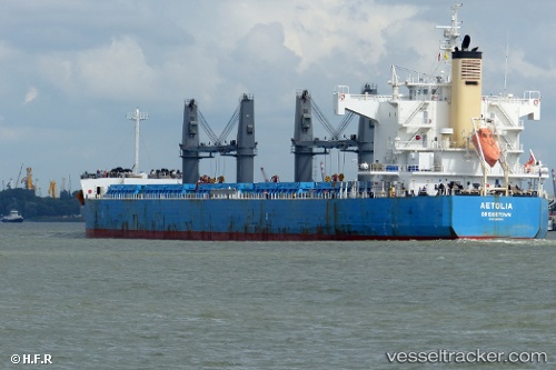
 Aetolia
Current Status
Where is the vessel?
Aetolia is currently in Near Alexandria, based on AIS data received less than 1h ago.
Latest AIS update:
Current position: 31.16941° N, 29.85515° E (Near Alexandria)
Average speed (last 7 days): Loading…
Average speed (last 30 days): Loading…
Vessel profile: Aetolia is a Bulk Carrier with dimensions 190m x 190m.
This page combines live AIS, route history, probable destination signals, nearby traffic, and port activity for practical vessel monitoring.
The current position of vessel Aetolia is 31.16941 lat / 29.85515 lng. Updated: 2026-03-30 21:21:00 UTCNearest reference points:
- Near Alexandria
- Near EL DEKHEILA
- 13 nm W of EL DEKHEILA
Currently sailing under the flag of Barbados ![]()
Aetolia built in 2010 year
Deadweight:
58106 tDetails:
Live Vessel Aetolia Analytics (details, animations, etc.)
Recent AIS points (UTC):
2026-03-30 15:41:56 UTC · 31.16945, 29.85514 · SOG 0 kn · COG 22°2026-03-30 17:45:06 UTC · 31.16947, 29.85517 · SOG 0 kn · COG 22°
2026-03-30 19:48:00 UTC · 31.16948, 29.85513 · SOG 0 kn · COG 22°
2026-03-30 21:21:00 UTC · 31.16941, 29.85515 · SOG 0 kn · COG 22°