 vesseltracker.com
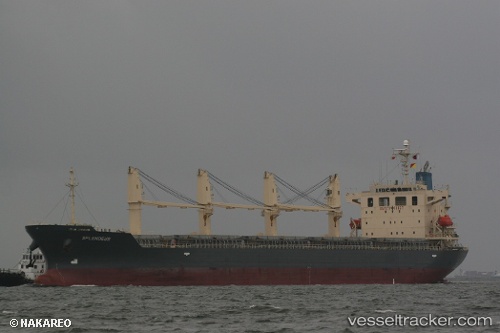
Obe Dinares
Current StatusWhere is the vessel?
Obe Dinares is currently in 10 nm N of Rozi, based on AIS data received about 1h ago.
Latest AIS update:
Current position: 22.73618° N, 70.03770° E (10 nm N of Rozi)
Average speed (last 7 days): Loading…
Average speed (last 30 days): Loading…
Vessel profile: Obe Dinares is a General Cargo Ship with dimensions 28m x 180m.
This page combines live AIS, route history, probable destination signals, nearby traffic, and port activity for practical vessel monitoring.
The current position of vessel Obe Dinares is 22.73618 lat / 70.03770 lng. Updated: 2026-05-16 02:21:09 UTCNearest reference points:
- 12 nm N of Rozi
- 15 nm N of Rozi
- Near Rozi
Details:
Live Vessel Obe Dinares Analytics (details, animations, etc.)
Recent AIS points (UTC):
2026-05-15 22:06:10 UTC · 22.73697, 70.03548 · SOG 0 kn · COG 54°2026-05-15 23:39:08 UTC · 22.73705, 70.03537 · SOG 0.1 kn · COG 58°
2026-05-16 01:42:07 UTC · 22.73678, 70.03573 · SOG 0 kn · COG 42°
2026-05-16 02:21:09 UTC · 22.73618, 70.03770 · SOG 0.3 kn · COG 342°