 vesseltracker.com
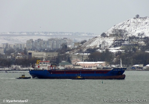
 NACI SELIMOGLU
Current Status
Where is the vessel?
NACI SELIMOGLU is currently in 44 nm S of Matera, based on AIS data received about 1h ago.
Latest AIS update:
Current position: 39.93771° N, 13.56990° E (44 nm S of Matera)
Average speed (last 7 days): Loading…
Average speed (last 30 days): Loading…
Vessel profile: NACI SELIMOGLU is a General Cargo Ship with dimensions 92m x 15m.
This page combines live AIS, route history, probable destination signals, nearby traffic, and port activity for practical vessel monitoring.
The current position of vessel NACI SELIMOGLU is 39.93771 lat / 13.56990 lng. Updated: 2026-04-24 23:25:53 UTCNearest reference points:
- 16 nm S of Matera
- Near Anacapri
- Near CAPRI
Currently sailing under the flag of Barbados ![]()
NACI SELIMOGLU built in 2007 year
Deadweight:
5229 tDetails:
Live Vessel NACI SELIMOGLU Analytics (details, animations, etc.)
Recent AIS points (UTC):
2026-04-24 20:14:15 UTC · 40.33733, 13.88612 · SOG 8.8 kn · COG 216°2026-04-24 21:34:54 UTC · 40.16778, 13.74424 · SOG 9.1 kn · COG 212°
2026-04-24 22:17:05 UTC · 40.08095, 13.67880 · SOG 7.8 kn · COG 212°
2026-04-24 23:25:53 UTC · 39.93771, 13.56990 · SOG 8.6 kn · COG 212°