 vesseltracker.com
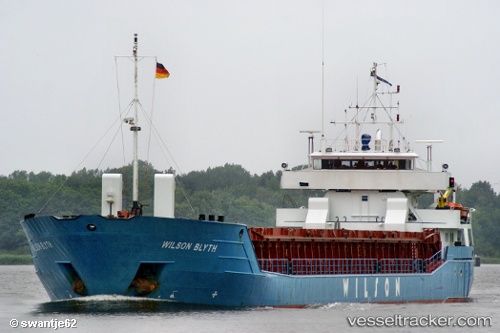
 WILSON BLYTH
Current Status
Where is the vessel?
WILSON BLYTH is currently in Near Town Quays/Drogheda, based on AIS data received about 1h ago.
Latest AIS update:
Current position: 53.72227° N, 6.30183° E (Near Town Quays/Drogheda)
Average speed (last 7 days): Loading…
Average speed (last 30 days): Loading…
Vessel profile: WILSON BLYTH is a General Cargo Ship with dimensions 87m x 12m.
This page combines live AIS, route history, probable destination signals, nearby traffic, and port activity for practical vessel monitoring.
The current position of vessel WILSON BLYTH is 53.72227 lat / 6.30183 lng. Updated: 2026-05-02 07:51:20 UTCNearest reference points:
- 14 nm NW of Town Quays/Drogheda
- Near Borkum
- Near Hoogkerk
Currently sailing under the flag of Barbados ![]()
WILSON BLYTH built in 1995 year
Deadweight:
3713 tDetails:
Live Vessel WILSON BLYTH Analytics (details, animations, etc.)
Recent AIS points (UTC):
2026-05-02 05:01:34 UTC · 53.55874, 5.46154 · SOG 11 kn · COG 72°2026-05-02 06:19:34 UTC · 53.63090, 5.84070 · SOG 11.1 kn · COG 71°
2026-05-02 07:16:13 UTC · 53.68962, 6.12316 · SOG 11.4 kn · COG 72°
2026-05-02 07:51:20 UTC · 53.72227, 6.30183 · SOG 11.4 kn · COG 72°