 vesseltracker.com
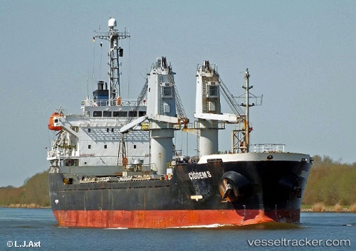
 A LINE
Current Status
Where is the vessel?
A LINE is currently in Near Fethiye, based on AIS data received about 1h ago.
Latest AIS update:
Current position: 36.64667° N, 29.10667° E (Near Fethiye)
Average speed (last 7 days): Loading…
Average speed (last 30 days): Loading…
Vessel profile: A LINE is a Bulk Carrier with dimensions m x m.
This page combines live AIS, route history, probable destination signals, nearby traffic, and port activity for practical vessel monitoring.
The current position of vessel A LINE is 36.64667 lat / 29.10667 lng. Updated: 2026-04-24 19:58:41 UTCNearest reference points:
- Near Fethiye
- Near GOCEK
- 10 nm S of GOCEK
Currently sailing under the flag of Barbados ![]()
Details:
Live Vessel A LINE Analytics (details, animations, etc.)
Recent AIS points (UTC):
2026-04-24 16:26:58 UTC · 36.53142, 28.63197 · SOG 11.2 kn · COG 85°2026-04-24 17:21:49 UTC · 36.55397, 28.84442 · SOG 11.1 kn · COG 64°
2026-04-24 19:21:28 UTC · 36.64895, 29.10752 · SOG 0 kn · COG 105°
2026-04-24 19:58:41 UTC · 36.64667, 29.10667 · SOG 0 kn · COG -1°