 vesseltracker.com
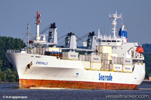
 EMERALD
Current Status
Where is the vessel?
EMERALD is currently in 24 nm NW of Moho Bilondo, based on AIS data received about 1h ago.
Latest AIS update:
Current position: 5.58333° S, 10.04167° E (24 nm NW of Moho Bilondo)
Average speed (last 7 days): Loading…
Average speed (last 30 days): Loading…
Vessel profile: EMERALD is a Reefer with dimensions m x m.
This page combines live AIS, route history, probable destination signals, nearby traffic, and port activity for practical vessel monitoring.
The current position of vessel EMERALD is -5.58333 lat / 10.04167 lng. Updated: 2026-04-25 18:58:09 UTCNearest reference points:
- Near N'Kossa Terminal
- 11 nm W of Cabinda
- Near Pointe Noire
Currently sailing under the flag of Barbados ![]()
Details:
Live Vessel EMERALD Analytics (details, animations, etc.)
Recent AIS points (UTC):
2026-04-25 16:22:07 UTC · -5.28167, 10.06333 · SOG 0 kn · COG -1°2026-04-25 17:34:55 UTC · -5.28524, 10.04987 · SOG 12.5 kn · COG 180°
2026-04-25 18:36:25 UTC · -5.50644, 10.04447 · SOG 12.8 kn · COG 181°
2026-04-25 18:58:09 UTC · -5.58333, 10.04167 · SOG 12 kn · COG -1°