 vesseltracker.com
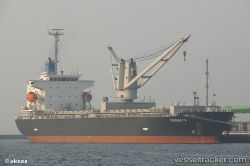
 PERMATA N
Current Status
Where is the vessel?
PERMATA N is currently in Near Bar, based on AIS data received about 1h ago.
Latest AIS update:
Current position: 42.08635° N, 19.08209° E (Near Bar)
Average speed (last 7 days): Loading…
Average speed (last 30 days): Loading…
Vessel profile: PERMATA N is a General Cargo with dimensions m x m.
This page combines live AIS, route history, probable destination signals, nearby traffic, and port activity for practical vessel monitoring.
The current position of vessel PERMATA N is 42.08635 lat / 19.08209 lng. Updated: 2026-04-24 16:15:54 UTCNearest reference points:
- Near TIVAT
- Near Zelenika
- Near Zelinika
Currently sailing under the flag of Barbados ![]()
Details:
Live Vessel PERMATA N Analytics (details, animations, etc.)
Recent AIS points (UTC):
2026-04-24 13:39:55 UTC · 42.08634, 19.08213 · SOG 0 kn · COG 287°2026-04-24 14:00:57 UTC · 42.08634, 19.08214 · SOG 0 kn · COG 287°
2026-04-24 16:09:52 UTC · 42.08635, 19.08210 · SOG 0 kn · COG 287°
2026-04-24 16:15:54 UTC · 42.08635, 19.08209 · SOG 0 kn · COG 287°