 vesseltracker.com
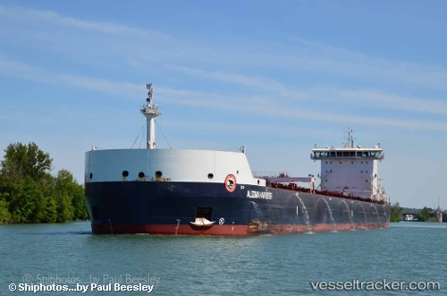
 Algoma Harvester
Current Status
Where is the vessel?
Algoma Harvester is currently in 17 nm NE of Pointe-aux-Outardes, based on AIS data received about 1h ago.
Latest AIS update:
Current position: 49.25500° N, 68.13167° W (17 nm NE of Pointe-aux-Outardes)
Average speed (last 7 days): Loading…
Average speed (last 30 days): Loading…
Vessel profile: Algoma Harvester is a Self Discharging Bulk Carrier with dimensions 226m x 24m.
This page combines live AIS, route history, probable destination signals, nearby traffic, and port activity for practical vessel monitoring.
The current position of vessel Algoma Harvester is 49.25500 lat / -68.13167 lng. Updated: 2026-04-24 02:27:46 UTCNearest reference points:
- 15 nm NW of Saint-Anaclet
- 22 nm N of Sainte-Anne-des-Monts
- Near Ile Aux Coudres
Currently sailing under the flag of Canada ![]()
Algoma Harvester built in 2014 year
Deadweight:
39400 tDetails:
Live Vessel Algoma Harvester Analytics (details, animations, etc.)
Recent AIS points (UTC):
2026-04-23 22:54:37 UTC · 49.25500, -68.13167 · SOG 0 kn · COG -1°2026-04-24 00:15:40 UTC · 49.25500, -68.13167 · SOG 0 kn · COG -1°
2026-04-24 02:04:44 UTC · 49.25466, -68.13094 · SOG 0 kn · COG 218°
2026-04-24 02:27:46 UTC · 49.25500, -68.13167 · SOG 0 kn · COG -1°