 vesseltracker.com
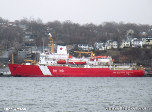
 Louis S St Laurent
Current Status
Where is the vessel?
Louis S St Laurent is currently in Near St. John’S, based on AIS data received less than 1h ago.
Latest AIS update:
Current position: 47.56945° N, 52.69601° W (Near St. John’S)
Average speed (last 7 days): Loading…
Average speed (last 30 days): Loading…
Vessel profile: Louis S St Laurent is a Icebreaker with dimensions 111m x 25m.
This page combines live AIS, route history, probable destination signals, nearby traffic, and port activity for practical vessel monitoring.
The current position of vessel Louis S St Laurent is 47.56945 lat / -52.69601 lng. Updated: 2026-05-14 22:02:54 UTCNearest reference points:
- Near St. John’S
- Near Witless Bay
- Near Catalina
Currently sailing under the flag of Canada ![]()
Louis S St Laurent built in 1969 year
Deadweight:
4640 tDetails:
Live Vessel Louis S St Laurent Analytics (details, animations, etc.)
Recent AIS points (UTC):
2026-05-14 19:17:54 UTC · 47.56955, -52.69596 · SOG 0 kn · COG 289°2026-05-14 20:17:54 UTC · 47.56947, -52.69589 · SOG 0 kn · COG 289°
2026-05-14 21:23:56 UTC · 47.56950, -52.69598 · SOG 0 kn · COG 289°
2026-05-14 22:02:54 UTC · 47.56945, -52.69601 · SOG 0 kn · COG 289°