 vesseltracker.com
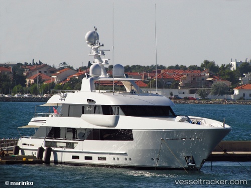
Moon Sand
Current StatusWhere is the vessel?
Moon Sand is currently in Near VARKIZA, based on AIS data received less than 1h ago.
Latest AIS update:
Current position: 37.81433° N, 23.81637° E (Near VARKIZA)
Average speed (last 7 days): Loading…
Average speed (last 30 days): Loading…
Vessel profile: Moon Sand is a Yacht with dimensions 8m x 45m.
This page combines live AIS, route history, probable destination signals, nearby traffic, and port activity for practical vessel monitoring.
The current position of vessel Moon Sand is 37.81433 lat / 23.81637 lng. Updated: 2026-05-15 04:01:34 UTCNearest reference points:
- Near Vouliagméni
- Near ALIMOS
- Near FLISVOS
Details:
Live Vessel Moon Sand Analytics (details, animations, etc.)
Recent AIS points (UTC):
2026-05-14 22:42:24 UTC · 37.81333, 23.81667 · SOG 0 kn · COG -1°2026-05-14 23:58:59 UTC · 37.81433, 23.81644 · SOG 0.6 kn · COG 252°
2026-05-15 01:04:59 UTC · 37.81440, 23.81639 · SOG 0.3 kn · COG 320°
2026-05-15 04:01:34 UTC · 37.81433, 23.81637 · SOG 0.5 kn · COG 331°