 vesseltracker.com
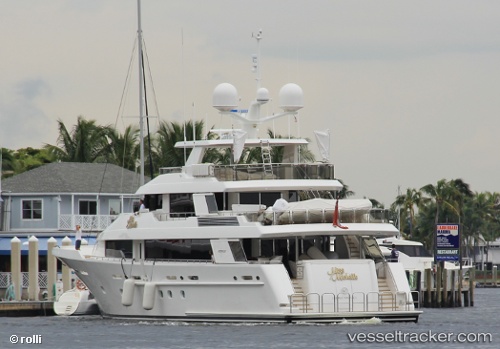
 TASIA II
Current Status
Where is the vessel?
TASIA II is currently in Near Rivera Beach, based on AIS data received about 14d ago.
Latest AIS update:
Current position: 26.71425° N, 80.04806° W (Near Rivera Beach)
Average speed (last 7 days): Loading…
Average speed (last 30 days): Loading…
Vessel profile: TASIA II is a Houseboat with dimensions 7m x 40m.
This page combines live AIS, route history, probable destination signals, nearby traffic, and port activity for practical vessel monitoring.
The current position of vessel TASIA II is 26.71425 lat / -80.04806 lng. Updated: 2026-05-01 19:46:14 UTCNearest reference points:
- Near Rivera Beach
- Near Palm Beach
- Near Lake Park
Currently sailing under the flag of Cayman Islands ![]()
TASIA II built in 2009 year
Deadweight:
0 tDetails:
Live Vessel TASIA II Analytics (details, animations, etc.)
Recent AIS points (UTC):
2026-05-01 19:46:14 UTC · 26.71425, -80.04806 · SOG 0 kn · COG -1°