 vesseltracker.com
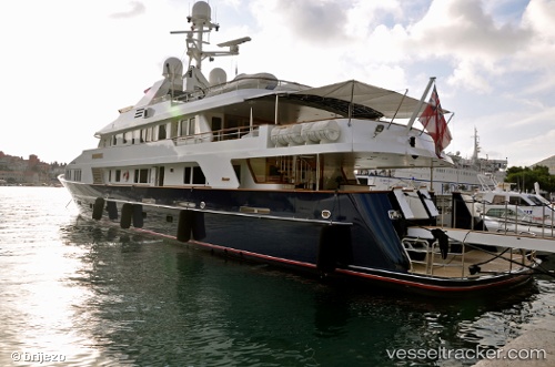
Blu 470
Current StatusWhere is the vessel?
Blu 470 is currently in Near El Puerto de Santa María, based on AIS data received about 1h ago.
Latest AIS update:
Current position: 36.57887° N, 6.25587° W (Near El Puerto de Santa María)
Average speed (last 7 days): Loading…
Average speed (last 30 days): Loading…
Vessel profile: Blu 470 is a Yacht with dimensions 9m x 48m.
This page combines live AIS, route history, probable destination signals, nearby traffic, and port activity for practical vessel monitoring.
The current position of vessel Blu 470 is 36.57887 lat / -6.25587 lng. Updated: 2026-05-14 07:21:45 UTCNearest reference points:
- Near El Puerto de Santa María
- Near Cadiz
- Near CHIPIONA
Details:
Live Vessel Blu 470 Analytics (details, animations, etc.)
Recent AIS points (UTC):
2026-05-14 04:12:48 UTC · 36.57887, -6.25588 · SOG 0 kn · COG 108°2026-05-14 06:18:46 UTC · 36.57885, -6.25590 · SOG 0 kn · COG 108°
2026-05-14 07:00:43 UTC · 36.57887, -6.25588 · SOG 0 kn · COG 108°
2026-05-14 07:21:45 UTC · 36.57887, -6.25587 · SOG 0 kn · COG 108°