 vesseltracker.com
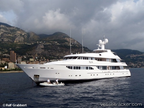
 Broadwater
Current Status
Where is the vessel?
Broadwater is currently in Near Monte-Carlo, based on AIS data received about 1h ago.
Latest AIS update:
Current position: 43.73671° N, 7.42362° E (Near Monte-Carlo)
Average speed (last 7 days): Loading…
Average speed (last 30 days): Loading…
Vessel profile: Broadwater is a Service Ship with dimensions 50m x 10m.
This page combines live AIS, route history, probable destination signals, nearby traffic, and port activity for practical vessel monitoring.
The current position of vessel Broadwater is 43.73671 lat / 7.42362 lng. Updated: 2026-05-13 19:56:33 UTCNearest reference points:
- Near Monaco
- Near Monte-Carlo
- Near SAINTJEAN CAP FERRAT
Currently sailing under the flag of Cayman Is ![]()
Broadwater built in 2000 year
Details:
Live Vessel Broadwater Analytics (details, animations, etc.)
Recent AIS points (UTC):
2026-05-13 16:35:00 UTC · 43.73671, 7.42361 · SOG 0.2 kn · COG 173°2026-05-13 17:29:31 UTC · 43.73671, 7.42362 · SOG 0.1 kn · COG 173°
2026-05-13 19:47:35 UTC · 43.73671, 7.42362 · SOG 0 kn · COG 173°
2026-05-13 19:56:33 UTC · 43.73671, 7.42362 · SOG 0 kn · COG 173°