 vesseltracker.com
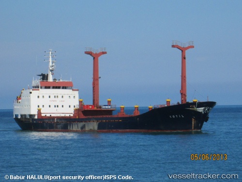
 ROYAL STAR
Current Status
Where is the vessel?
ROYAL STAR is currently in Near Tartous, based on AIS data received less than 1h ago.
Latest AIS update:
Current position: 34.90295° N, 35.84437° E (Near Tartous)
Average speed (last 7 days): Loading…
Average speed (last 30 days): Loading…
Vessel profile: ROYAL STAR is a General Cargo with dimensions m x m.
This page combines live AIS, route history, probable destination signals, nearby traffic, and port activity for practical vessel monitoring.
The current position of vessel ROYAL STAR is 34.90295 lat / 35.84437 lng. Updated: 2026-05-15 05:04:28 UTCNearest reference points:
- Near Tartous
- Near Tripoli
- Near Al Ladhiqiyah
Currently sailing under the flag of Saint Kitts and Nevis ![]()
Details:
Live Vessel ROYAL STAR Analytics (details, animations, etc.)
Recent AIS points (UTC):
2026-05-15 01:00:06 UTC · 34.90006, 35.84468 · SOG 0.1 kn · COG -1°2026-05-15 03:34:02 UTC · 34.89993, 35.84468 · SOG 2.5 kn · COG -1°
2026-05-15 04:17:21 UTC · 34.89972, 35.84513 · SOG 0.7 kn · COG -1°
2026-05-15 05:04:28 UTC · 34.90295, 35.84437 · SOG 0.5 kn · COG -1°