 vesseltracker.com
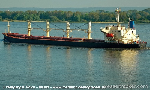
 SAMANTA
Current Status
Where is the vessel?
SAMANTA is currently in 26 nm SW of Assaluyeh, based on AIS data received less than 1h ago.
Latest AIS update:
Current position: 27.04215° N, 52.36351° E (26 nm SW of Assaluyeh)
Average speed (last 7 days): Loading…
Average speed (last 30 days): Loading…
Vessel profile: SAMANTA is a Bulk Carrier with dimensions m x m.
This page combines live AIS, route history, probable destination signals, nearby traffic, and port activity for practical vessel monitoring.
The current position of vessel SAMANTA is 27.04215 lat / 52.36351 lng. Updated: 2026-04-28 13:09:57 UTCNearest reference points:
- Near ASALUYEH
- Near Sarooj Anchorage
- Near Dayyer
Currently sailing under the flag of Saint Kitts and Nevis ![]()
Details:
Live Vessel SAMANTA Analytics (details, animations, etc.)
Recent AIS points (UTC):
2026-04-28 09:54:28 UTC · 26.84342, 52.78280 · SOG 8.2 kn · COG 295°2026-04-28 11:02:07 UTC · 26.91782, 52.63521 · SOG 8 kn · COG 291°
2026-04-28 11:36:58 UTC · 26.95324, 52.55985 · SOG 7.8 kn · COG 296°
2026-04-28 13:09:57 UTC · 27.04215, 52.36351 · SOG 7.5 kn · COG 293°