 vesseltracker.com
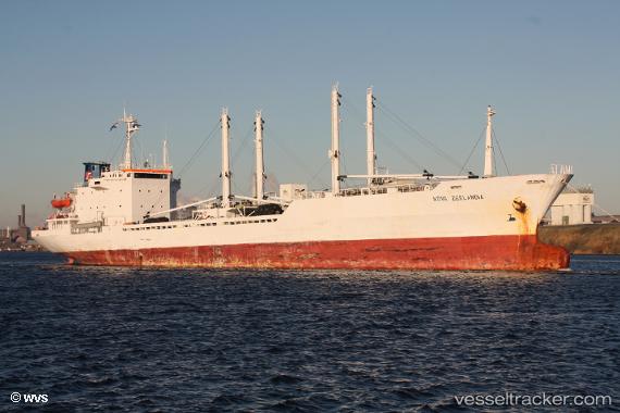
 ALMAJD
Current Status
Where is the vessel?
ALMAJD is currently in Near Mamonal, based on AIS data received less than 1h ago.
Latest AIS update:
Current position: 10.34354° N, 75.50578° W (Near Mamonal)
Average speed (last 7 days): Loading…
Average speed (last 30 days): Loading…
Vessel profile: ALMAJD is a Reefer with dimensions m x m.
This page combines live AIS, route history, probable destination signals, nearby traffic, and port activity for practical vessel monitoring.
The current position of vessel ALMAJD is 10.34354 lat / -75.50578 lng. Updated: 2026-05-15 04:15:27 UTCNearest reference points:
- Near Contecar
- Near Sociedad Portuaria Regional Cartagena
- Near Santa Marta
Currently sailing under the flag of Saint Kitts and Nevis ![]()
Details:
Live Vessel ALMAJD Analytics (details, animations, etc.)
Recent AIS points (UTC):
2026-05-14 23:08:07 UTC · 10.34352, -75.50576 · SOG 0 kn · COG -1°2026-05-14 23:30:10 UTC · 10.34351, -75.50576 · SOG 0 kn · COG -1°
2026-05-15 03:56:34 UTC · 10.34352, -75.50577 · SOG 0 kn · COG -1°
2026-05-15 04:15:27 UTC · 10.34354, -75.50578 · SOG 0 kn · COG -1°