 vesseltracker.com
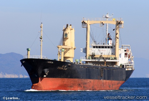
 LEO
LEO
Current Status
Where is the vessel?
LEO is currently in 398 nm NW of Tinaquillo, based on AIS data received less than 1h ago.
Latest AIS update:
Current position: 15.97783° N, 65.56367° E (398 nm NW of Tinaquillo)
Average speed (last 7 days): Loading…
Average speed (last 30 days): Loading…
Vessel profile: LEO is a General Cargo with dimensions m x m.
This page combines live AIS, route history, probable destination signals, nearby traffic, and port activity for practical vessel monitoring.
The current position of vessel LEO is 15.97783 lat / 65.56367 lng. Updated: 2026-04-24 20:13:41 UTCNearest reference points:
- Open sea, approx. 401 nm off the nearest listed port
- Open sea, approx. 404 nm off the nearest listed port
- Open sea, approx. 400 nm off the nearest listed port
Currently sailing under the flag of Saint Kitts and Nevis ![]()
Details:
Live Vessel LEO Analytics (details, animations, etc.)
Recent AIS points (UTC):
2026-04-24 16:00:22 UTC · 16.09515, 66.13493 · SOG 7.4 kn · COG -1°2026-04-24 16:00:22 UTC · 16.09515, 66.13493 · SOG 7.4 kn · COG -1°
2026-04-24 19:53:14 UTC · 15.98770, 65.61037 · SOG 7.9 kn · COG -1°
2026-04-24 20:13:41 UTC · 15.97783, 65.56367 · SOG 8.2 kn · COG -1°