 vesseltracker.com
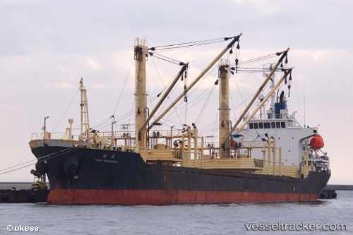
 THURAYA M
Current Status
Where is the vessel?
THURAYA M is currently in 71 nm SW of Al Qahmah, based on AIS data received less than 1h ago.
Latest AIS update:
Current position: 17.55572° N, 40.52741° E (71 nm SW of Al Qahmah)
Average speed (last 7 days): Loading…
Average speed (last 30 days): Loading…
Vessel profile: THURAYA M is a General Cargo with dimensions m x m.
This page combines live AIS, route history, probable destination signals, nearby traffic, and port activity for practical vessel monitoring.
The current position of vessel THURAYA M is 17.55572 lat / 40.52741 lng. Updated: 2026-05-15 06:36:24 UTCNearest reference points:
- 92 nm SW of Al Qahmah
- 99 nm SW of Al Qunfudah
- Near Jazan Economic City
Currently sailing under the flag of Saint Kitts and Nevis ![]()
Details:
Live Vessel THURAYA M Analytics (details, animations, etc.)
Recent AIS points (UTC):
2026-05-15 03:14:58 UTC · 17.03962, 40.80642 · SOG 10.3 kn · COG 337°2026-05-15 03:14:58 UTC · 17.03962, 40.80642 · SOG 10.3 kn · COG 337°
2026-05-15 05:11:46 UTC · 17.33528, 40.64475 · SOG 10.2 kn · COG 333°
2026-05-15 06:36:24 UTC · 17.55572, 40.52741 · SOG 10.5 kn · COG 331°