 vesseltracker.com
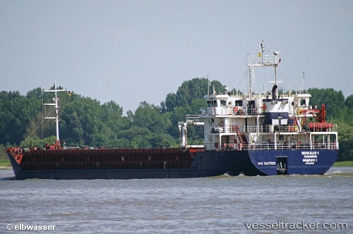
Vessel DREMORA 1 IMO: 9407029, MMSI: 341654000 General Cargo Ship
UTC, 40.89620, 28.61408, course: 265, speed: 8.3
UTC, 40.85016, 28.21428, course: 261, speed: 8.4
2026-03-03 09:40:06 UTC, 40.88516, 27.93252, course: -1, speed: 8.3
Live AIS position:
UTC. Near Marmara Ereglisi),
updated 2026-03-03 09:40:06 UTC.
Find the position of the vessel DREMORA 1 on the map. The latter are known coordinates and path.
marine traffic ship tracker show on live map
The current position of vessel DREMORA 1 is 40.88516 lat / 27.93252 lng. Updated: 2026-03-03 09:40:06 UTCCurrently sailing under the flag of St.Kitts and Nevis
DREMORA 1 built in 2008 year
Deadweight:
5453 tDetails:
Last coordinates of the vessel:
UTC, 40.94468, 28.90091, course: 231, speed: 8.8UTC, 40.89620, 28.61408, course: 265, speed: 8.3
UTC, 40.85016, 28.21428, course: 261, speed: 8.4
2026-03-03 09:40:06 UTC, 40.88516, 27.93252, course: -1, speed: 8.3