 vesseltracker.com
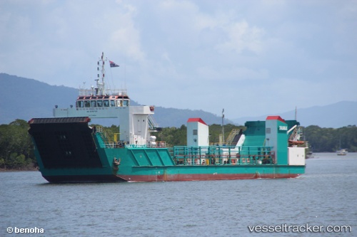
 FIREFLY
Current Status
Where is the vessel?
FIREFLY is currently in Near Pemba, based on AIS data received less than 1h ago.
Latest AIS update:
Current position: 12.99607° S, 40.48880° E (Near Pemba)
Average speed (last 7 days): Loading…
Average speed (last 30 days): Loading…
Vessel profile: FIREFLY is a Landing Craft with dimensions m x m.
This page combines live AIS, route history, probable destination signals, nearby traffic, and port activity for practical vessel monitoring.
The current position of vessel FIREFLY is -12.99607 lat / 40.48880 lng. Updated: 2026-05-14 03:55:59 UTCNearest reference points:
- 10 nm N of NACALA PORTO
- Near NACALA PORTO
Currently sailing under the flag of Saint Kitts and Nevis ![]()
Details:
Live Vessel FIREFLY Analytics (details, animations, etc.)
Recent AIS points (UTC):
2026-05-13 23:43:13 UTC · -12.99500, 40.48833 · SOG 0 kn · COG -1°2026-05-14 01:40:13 UTC · -12.99500, 40.48833 · SOG 0 kn · COG -1°
2026-05-14 02:52:12 UTC · -12.99500, 40.48833 · SOG 0 kn · COG -1°
2026-05-14 03:55:59 UTC · -12.99607, 40.48880 · SOG 0 kn · COG -1°