 vesseltracker.com
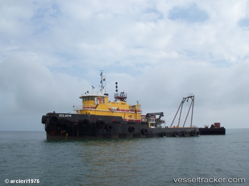
 Goliath
Current Status
Where is the vessel?
Goliath is currently in Near Cantarell, based on AIS data received less than 1h ago.
Latest AIS update:
Current position: 19.57077° N, 92.09355° W (Near Cantarell)
Average speed (last 7 days): Loading…
Average speed (last 30 days): Loading…
Vessel profile: Goliath is a [tug.offshore_tug_supply] with dimensions 39m x 39m.
This page combines live AIS, route history, probable destination signals, nearby traffic, and port activity for practical vessel monitoring.
The current position of vessel Goliath is 19.57077 lat / -92.09355 lng. Updated: 2026-04-29 00:07:35 UTCNearest reference points:
- Near Yùum K'Ak'Náab
- 18 nm S of Yùum K'Ak'Náab
- 35 nm S of Yùum K'Ak'Náab
Currently sailing under the flag of Mexico ![]()
Details:
Live Vessel Goliath Analytics (details, animations, etc.)
Recent AIS points (UTC):
2026-04-28 19:42:32 UTC · 19.58149, -92.10881 · SOG 1.4 kn · COG -1°2026-04-28 22:21:50 UTC · 19.57088, -92.09239 · SOG 0.7 kn · COG -1°
2026-04-28 23:01:52 UTC · 19.57027, -92.09170 · SOG 0.8 kn · COG -1°
2026-04-29 00:07:35 UTC · 19.57077, -92.09355 · SOG 0.1 kn · COG -1°