 vesseltracker.com
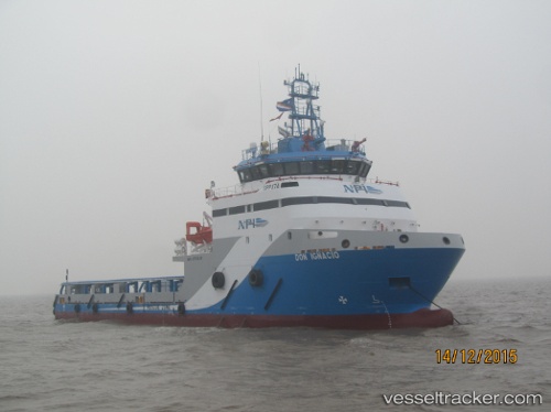
 Don Ignacio
Current Status
Where is the vessel?
Don Ignacio is currently in Near PUERTO PESQUERO, based on AIS data received about 3d ago.
Latest AIS update:
Current position: 18.64179° N, 91.84351° W (Near PUERTO PESQUERO)
Average speed (last 7 days): Loading…
Average speed (last 30 days): Loading…
Vessel profile: Don Ignacio is a Offshore Tug Supply Ship with dimensions 62m x 62m.
This page combines live AIS, route history, probable destination signals, nearby traffic, and port activity for practical vessel monitoring.
The current position of vessel Don Ignacio is 18.64179 lat / -91.84351 lng. Updated: 2026-04-24 08:07:16 UTCNearest reference points:
- Near PUERTO PESQUERO
- 35 nm S of Yùum K'Ak'Náab
- 18 nm S of Yùum K'Ak'Náab
Currently sailing under the flag of Mexico ![]()
Details:
Live Vessel Don Ignacio Analytics (details, animations, etc.)
Recent AIS points (UTC):
2026-04-24 08:07:16 UTC · 18.64179, -91.84351 · SOG 0 kn · COG -1°2026-04-24 08:07:16 UTC · 18.64179, -91.84351 · SOG 0 kn · COG -1°
2026-04-24 08:07:16 UTC · 18.64179, -91.84351 · SOG 0 kn · COG -1°
2026-04-24 08:07:16 UTC · 18.64179, -91.84351 · SOG 0 kn · COG -1°