 vesseltracker.com
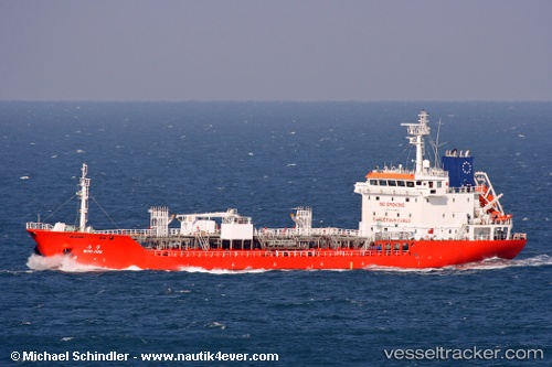
 GEB
GEB
Current Status
Where is the vessel?
GEB is currently in 17 nm E of Il-Kappara, based on AIS data received less than 1h ago.
Latest AIS update:
Current position: 35.94946° N, 14.88728° E (17 nm E of Il-Kappara)
Average speed (last 7 days): Loading…
Average speed (last 30 days): Loading…
Vessel profile: GEB is a Tanker D with dimensions m x m.
This page combines live AIS, route history, probable destination signals, nearby traffic, and port activity for practical vessel monitoring.
The current position of vessel GEB is 35.94946 lat / 14.88728 lng. Updated: 2026-04-30 19:59:18 UTCNearest reference points:
- 13 nm E of Il-Kappara
- 18 nm E of Il-Kappara
- Near Xghajra
Currently sailing under the flag of Nicaragua ![]()
Details:
Live Vessel GEB Analytics (details, animations, etc.)
Recent AIS points (UTC):
2026-04-30 17:03:06 UTC · 35.94945, 14.88727 · SOG 0 kn · COG 268°2026-04-30 17:47:10 UTC · 35.94945, 14.88742 · SOG 0 kn · COG 268°
2026-04-30 19:34:59 UTC · 35.94953, 14.88736 · SOG 0 kn · COG 268°
2026-04-30 19:59:18 UTC · 35.94946, 14.88728 · SOG 0 kn · COG 268°