 vesseltracker.com
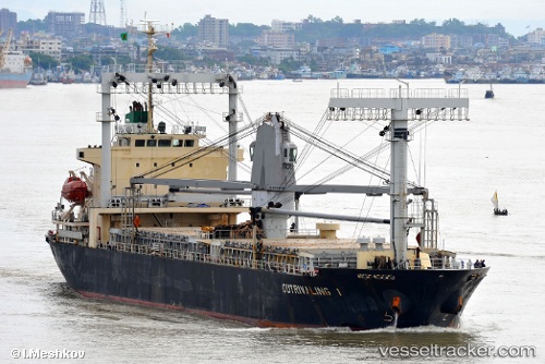
 Mariwit
Current Status
Where is the vessel?
Mariwit is currently in 192 nm SE of GANGAVARAM, based on AIS data received about 1h ago.
Latest AIS update:
Current position: 15.07833° N, 85.26333° E (192 nm SE of GANGAVARAM)
Average speed (last 7 days): Loading…
Average speed (last 30 days): Loading…
Vessel profile: Mariwit is a General Cargo Ship with dimensions 119m x 19m.
This page combines live AIS, route history, probable destination signals, nearby traffic, and port activity for practical vessel monitoring.
The current position of vessel Mariwit is 15.07833 lat / 85.26333 lng. Updated: 2026-05-15 19:56:05 UTCCurrently sailing under the flag of Panama ![]()
Mariwit built in 2009 year
Deadweight:
11500 tDetails:
Live Vessel Mariwit Analytics (details, animations, etc.)
Recent AIS points (UTC):
2026-05-15 16:59:07 UTC · 15.31167, 84.92667 · SOG 8 kn · COG -1°2026-05-15 18:17:08 UTC · 15.20167, 85.07667 · SOG 8 kn · COG -1°
2026-05-15 19:50:05 UTC · 15.08667, 85.25167 · SOG 7 kn · COG -1°
2026-05-15 19:56:05 UTC · 15.07833, 85.26333 · SOG 7 kn · COG -1°