 vesseltracker.com
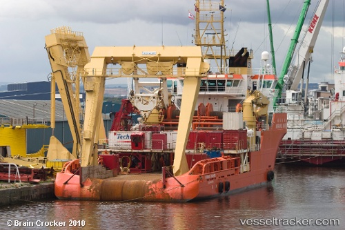
 NORMAND MARINER
Current Status
Where is the vessel?
NORMAND MARINER is currently in 42 nm NW of Sebang, based on AIS data received about 134d ago.
Latest AIS update:
Current position: 6.24218° N, 94.68337° E (42 nm NW of Sebang)
Average speed (last 7 days): Loading…
Average speed (last 30 days): Loading…
Vessel profile: NORMAND MARINER is a Offshore Tug/Supply Ship with dimensions 82m x 20m.
This page combines live AIS, route history, probable destination signals, nearby traffic, and port activity for practical vessel monitoring.
The current position of vessel NORMAND MARINER is 6.24218 lat / 94.68337 lng. Updated: 2025-12-31 06:20:37 UTCNearest reference points:
- 48 nm NW of Sebang
- 28 nm NW of Sebang
- 21 nm N of Sebang
Currently sailing under the flag of Panama ![]()
NORMAND MARINER built in 2002 year
Deadweight:
3694 tDetails:
Live Vessel NORMAND MARINER Analytics (details, animations, etc.)
Recent AIS points (UTC):
2025-12-31 06:20:37 UTC · 6.24218, 94.68337 · SOG 12 kn · COG 245°