 vesseltracker.com
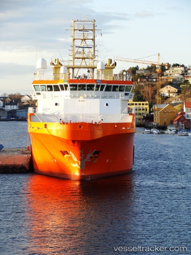
 NORMAND MASTER
Current Status
Where is the vessel?
NORMAND MASTER is currently in Open sea, approx. 428 nm off the nearest listed port, based on AIS data received about 251d ago.
Latest AIS update:
Current position: 20.01051° S, 0.44591° E (Open sea, approx. 428 nm off the nearest listed port)
Average speed (last 7 days): Loading…
Average speed (last 30 days): Loading…
Vessel profile: NORMAND MASTER is a Offshore Tug/Supply Ship with dimensions 20m x 83m.
This page combines live AIS, route history, probable destination signals, nearby traffic, and port activity for practical vessel monitoring.
The current position of vessel NORMAND MASTER is -20.01051 lat / 0.44591 lng. Updated: 2025-09-05 19:38:56 UTCNearest reference points:
- Open sea, approx. 428 nm off the nearest listed port
- Open sea, approx. 440 nm off the nearest listed port
- Open sea, approx. 439 nm off the nearest listed port
Currently sailing under the flag of Panama ![]()
NORMAND MASTER built in 2003 year
Deadweight:
3737 tDetails:
Live Vessel NORMAND MASTER Analytics (details, animations, etc.)
Recent AIS points (UTC):
2025-09-05 19:38:56 UTC · -20.01051, 0.44591 · SOG 0 kn · COG -1°