 vesseltracker.com
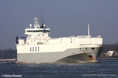
 MINCHAH
Current Status
Where is the vessel?
MINCHAH is currently in 19 nm N of Baracoa, based on AIS data received less than 1h ago.
Latest AIS update:
Current position: 20.67667° N, 74.51667° W (19 nm N of Baracoa)
Average speed (last 7 days): Loading…
Average speed (last 30 days): Loading…
Vessel profile: MINCHAH is a Vehicles Carrier with dimensions 18m x 125m.
This page combines live AIS, route history, probable destination signals, nearby traffic, and port activity for practical vessel monitoring.
The current position of vessel MINCHAH is 20.67667 lat / -74.51667 lng. Updated: 2026-04-24 07:19:36 UTCNearest reference points:
- 47 nm SW of Cockburn Harbour
- 56 nm SW of Cockburn Harbour
Currently sailing under the flag of Panama ![]()
MINCHAH built in 1997 year
Deadweight:
4442 tDetails:
Live Vessel MINCHAH Analytics (details, animations, etc.)
Recent AIS points (UTC):
2026-04-24 04:43:09 UTC · 20.48667, -74.13667 · SOG 9 kn · COG -1°2026-04-24 06:13:23 UTC · 20.59333, -74.35500 · SOG 9 kn · COG -1°
2026-04-24 07:10:33 UTC · 20.66500, -74.49500 · SOG 9 kn · COG -1°
2026-04-24 07:19:36 UTC · 20.67667, -74.51667 · SOG 9 kn · COG -1°