 vesseltracker.com
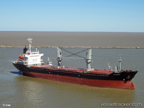
 ERKUL S
Current Status
Where is the vessel?
ERKUL S is currently in Near ABU QIR, based on AIS data received less than 1h ago.
Latest AIS update:
Current position: 31.33201° N, 30.08123° E (Near ABU QIR)
Average speed (last 7 days): Loading…
Average speed (last 30 days): Loading…
Vessel profile: ERKUL S is a General Cargo Ship with dimensions 21m x 128m.
This page combines live AIS, route history, probable destination signals, nearby traffic, and port activity for practical vessel monitoring.
The current position of vessel ERKUL S is 31.33201 lat / 30.08123 lng. Updated: 2026-04-25 14:22:27 UTCNearest reference points:
- Near Alexandria
- Near EL DEKHEILA
- 13 nm W of EL DEKHEILA
Currently sailing under the flag of Panama ![]()
ERKUL S built in 1999 year
Deadweight:
13347 tDetails:
Live Vessel ERKUL S Analytics (details, animations, etc.)
Recent AIS points (UTC):
2026-04-25 09:16:20 UTC · 31.33205, 30.08120 · SOG 0 kn · COG -1°2026-04-25 11:01:22 UTC · 31.33206, 30.08122 · SOG 0 kn · COG -1°
2026-04-25 11:01:22 UTC · 31.33206, 30.08122 · SOG 0 kn · COG -1°
2026-04-25 14:22:27 UTC · 31.33201, 30.08123 · SOG 0 kn · COG -1°