 vesseltracker.com
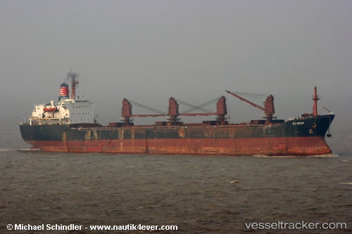
 AN YANG
Current Status
Where is the vessel?
AN YANG is currently in 28 nm SW of Okha, based on AIS data received about 1h ago.
Latest AIS update:
Current position: 22.27127° N, 68.63689° E (28 nm SW of Okha)
Average speed (last 7 days): Loading…
Average speed (last 30 days): Loading…
Vessel profile: AN YANG is a Cargo with dimensions m x m.
This page combines live AIS, route history, probable destination signals, nearby traffic, and port activity for practical vessel monitoring.
The current position of vessel AN YANG is 22.27127 lat / 68.63689 lng. Updated: 2026-05-02 16:10:21 UTCNearest reference points:
- 13 nm W of Måndvi
- 49 nm S of Positra
- 54 nm S of Positra
Currently sailing under the flag of Panama ![]()
Details:
Live Vessel AN YANG Analytics (details, animations, etc.)
Recent AIS points (UTC):
2026-05-02 07:02:03 UTC · 22.27094, 68.63589 · SOG 0 kn · COG 264°2026-05-02 07:02:03 UTC · 22.27094, 68.63589 · SOG 0 kn · COG 264°
2026-05-02 15:22:20 UTC · 22.27088, 68.63698 · SOG 0.3 kn · COG 263°
2026-05-02 16:10:21 UTC · 22.27127, 68.63689 · SOG 0.7 kn · COG 238°