 vesseltracker.com
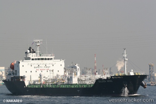
 ABC IRIS
Current Status
Where is the vessel?
ABC IRIS is currently in 14 nm N of Port Said, based on AIS data received about 1h ago.
Latest AIS update:
Current position: 31.48687° N, 32.25937° E (14 nm N of Port Said)
Average speed (last 7 days): Loading…
Average speed (last 30 days): Loading…
Vessel profile: ABC IRIS is a Oil/Chemical Tanker with dimensions m x m.
This page combines live AIS, route history, probable destination signals, nearby traffic, and port activity for practical vessel monitoring.
The current position of vessel ABC IRIS is 31.48687 lat / 32.25937 lng. Updated: 2026-04-29 06:06:50 UTCNearest reference points:
- 15 nm N of Port Said
- 14 nm N of Port Said
- 16 nm N of Port Said
Currently sailing under the flag of Panama ![]()
Details:
Live Vessel ABC IRIS Analytics (details, animations, etc.)
Recent AIS points (UTC):
2026-04-29 01:35:01 UTC · 31.43179, 32.28026 · SOG 0 kn · COG 320°2026-04-29 04:05:05 UTC · 31.43184, 32.28034 · SOG 0 kn · COG 309°
2026-04-29 04:35:00 UTC · 31.43192, 32.28033 · SOG 0 kn · COG 305°
2026-04-29 06:06:50 UTC · 31.48687, 32.25937 · SOG 4.7 kn · COG 0°