 vesseltracker.com
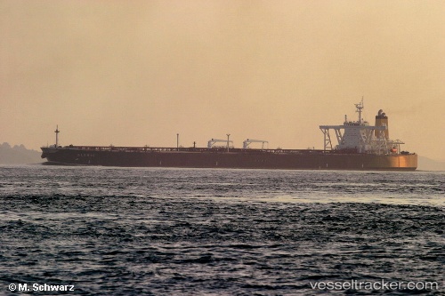
 TEJAS
TEJAS
Current Status
Where is the vessel?
TEJAS is currently in 154 nm SE of Lü-hua Shan, based on AIS data received less than 1h ago.
Latest AIS update:
Current position: 29.70937° N, 125.29260° E (154 nm SE of Lü-hua Shan)
Average speed (last 7 days): Loading…
Average speed (last 30 days): Loading…
Vessel profile: TEJAS is a Tanker with dimensions m x m.
This page combines live AIS, route history, probable destination signals, nearby traffic, and port activity for practical vessel monitoring.
The current position of vessel TEJAS is 29.70937 lat / 125.29260 lng. Updated: 2026-04-29 03:42:27 UTCNearest reference points:
- 165 nm SE of Lü-hua Shan
- 160 nm E of Lü-hua Shan
- 176 nm S of Hwasun
Currently sailing under the flag of Panama ![]()
Details:
Live Vessel TEJAS Analytics (details, animations, etc.)
Recent AIS points (UTC):
2026-04-28 19:19:26 UTC · 28.56742, 124.36975 · SOG 9.1 kn · COG 32°2026-04-29 01:10:52 UTC · 29.34948, 124.96327 · SOG 11 kn · COG 36°
2026-04-29 02:14:42 UTC · 29.50020, 125.10412 · SOG 11.1 kn · COG 39°
2026-04-29 03:42:27 UTC · 29.70937, 125.29260 · SOG 10.9 kn · COG 35°