 vesseltracker.com
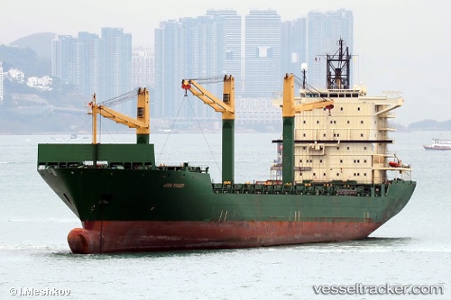
 MERATUS JAYAGIRI
Current Status
Where is the vessel?
MERATUS JAYAGIRI is currently in 67 nm E of Kampung Jawa, based on AIS data received about 2h ago.
Latest AIS update:
Current position: 3.11612° N, 104.62289° E (67 nm E of Kampung Jawa)
Average speed (last 7 days): Loading…
Average speed (last 30 days): Loading…
Vessel profile: MERATUS JAYAGIRI is a Container Ship with dimensions m x m.
This page combines live AIS, route history, probable destination signals, nearby traffic, and port activity for practical vessel monitoring.
The current position of vessel MERATUS JAYAGIRI is 3.11612 lat / 104.62289 lng. Updated: 2026-04-25 20:10:03 UTCNearest reference points:
- 80 nm SW of Terempa
- 64 nm NE of PENGERANG
- 53 nm NE of PENGERANG
Currently sailing under the flag of Panama ![]()
Details:
Live Vessel MERATUS JAYAGIRI Analytics (details, animations, etc.)
Recent AIS points (UTC):
2026-04-25 16:10:21 UTC · 3.77833, 104.36500 · SOG 10 kn · COG -1°2026-04-25 17:49:23 UTC · 3.50333, 104.47167 · SOG 10 kn · COG -1°
2026-04-25 18:31:20 UTC · 3.38833, 104.51833 · SOG 10 kn · COG -1°
2026-04-25 20:10:03 UTC · 3.11612, 104.62289 · SOG 10.5 kn · COG 157°