 vesseltracker.com
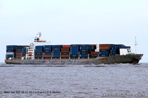
 AN HAI
Current Status
Where is the vessel?
AN HAI is currently in Near Jeddah, based on AIS data received less than 1h ago.
Latest AIS update:
Current position: 21.44972° N, 39.15899° E (Near Jeddah)
Average speed (last 7 days): Loading…
Average speed (last 30 days): Loading…
Vessel profile: AN HAI is a Container Ship with dimensions m x m.
This page combines live AIS, route history, probable destination signals, nearby traffic, and port activity for practical vessel monitoring.
The current position of vessel AN HAI is 21.44972 lat / 39.15899 lng. Updated: 2026-05-16 16:09:49 UTCNearest reference points:
- Near Jeddah
- Near Tusdeer Free Zone
- 10 nm SW of Jeddah
Currently sailing under the flag of Panama ![]()
Details:
Live Vessel AN HAI Analytics (details, animations, etc.)
Recent AIS points (UTC):
2026-05-16 13:31:31 UTC · 21.44965, 39.15890 · SOG 0 kn · COG 351°2026-05-16 14:04:34 UTC · 21.44957, 39.15893 · SOG 0 kn · COG 351°
2026-05-16 16:09:49 UTC · 21.44972, 39.15899 · SOG 0 kn · COG 351°
2026-05-16 16:09:49 UTC · 21.44972, 39.15899 · SOG 0 kn · COG 351°