 vesseltracker.com
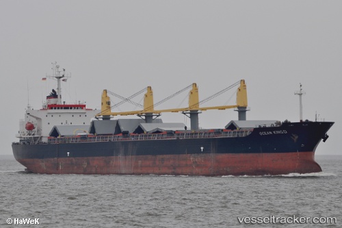
 SANTIYA
Current Status
Where is the vessel?
SANTIYA is currently in Near BAKIRKOY, based on AIS data received less than 1h ago.
Latest AIS update:
Current position: 40.93831° N, 28.87150° E (Near BAKIRKOY)
Average speed (last 7 days): Loading…
Average speed (last 30 days): Loading…
Vessel profile: SANTIYA is a Bulk Carrier with dimensions m x m.
This page combines live AIS, route history, probable destination signals, nearby traffic, and port activity for practical vessel monitoring.
The current position of vessel SANTIYA is 40.93831 lat / 28.87150 lng. Updated: 2026-05-15 00:01:31 UTCNearest reference points:
- Near BAKIRKOY
- Near ZEYTINBURNU
- Near Davutpasa
Currently sailing under the flag of Panama ![]()
Details:
Live Vessel SANTIYA Analytics (details, animations, etc.)
Recent AIS points (UTC):
2026-05-14 19:48:47 UTC · 40.93738, 28.86790 · SOG 0.1 kn · COG 66°2026-05-14 21:37:10 UTC · 40.93750, 28.86795 · SOG 0 kn · COG 67°
2026-05-14 22:39:48 UTC · 40.93664, 28.86957 · SOG 0.1 kn · COG 3°
2026-05-15 00:01:31 UTC · 40.93831, 28.87150 · SOG 0 kn · COG 259°