 vesseltracker.com
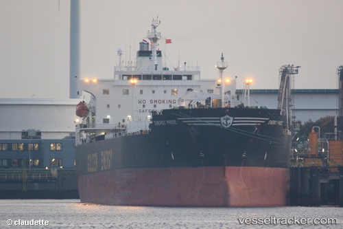
 OCEAN THALIA
Current Status
Where is the vessel?
OCEAN THALIA is currently in 30 nm S of Carchuna, based on AIS data received about 1h ago.
Latest AIS update:
Current position: 36.23710° N, 3.22099° W (30 nm S of Carchuna)
Average speed (last 7 days): Loading…
Average speed (last 30 days): Loading…
Vessel profile: OCEAN THALIA is a Oil Products Tanker with dimensions m x m.
This page combines live AIS, route history, probable destination signals, nearby traffic, and port activity for practical vessel monitoring.
The current position of vessel OCEAN THALIA is 36.23710 lat / -3.22099 lng. Updated: 2026-05-15 08:12:29 UTCNearest reference points:
- 29 nm S of Carchuna
- 23 nm S of Carchuna
- Near ADRA
Currently sailing under the flag of Panama ![]()
Details:
Live Vessel OCEAN THALIA Analytics (details, animations, etc.)
Recent AIS points (UTC):
2026-05-15 05:05:38 UTC · 36.14007, -4.00959 · SOG 13 kn · COG 82°2026-05-15 05:58:58 UTC · 36.16734, -3.78169 · SOG 12.1 kn · COG 79°
2026-05-15 07:33:48 UTC · 36.21490, -3.38493 · SOG 12.5 kn · COG 75°
2026-05-15 08:12:29 UTC · 36.23710, -3.22099 · SOG 12.4 kn · COG 76°