 vesseltracker.com
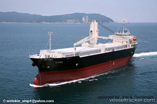
 KAISA
KAISA
Current Status
Where is the vessel?
KAISA is currently in Near PASIR PANJANG Terminal, based on AIS data received less than 1h ago.
Latest AIS update:
Current position: 1.30038° N, 103.72696° E (Near PASIR PANJANG Terminal)
Average speed (last 7 days): Loading…
Average speed (last 30 days): Loading…
Vessel profile: KAISA is a General Cargo with dimensions m x m.
This page combines live AIS, route history, probable destination signals, nearby traffic, and port activity for practical vessel monitoring.
The current position of vessel KAISA is 1.30038 lat / 103.72696 lng. Updated: 2026-04-28 22:32:42 UTCNearest reference points:
- Near PASIR PANJANG Terminal
- Near Pulau Ayer Chawan
- Near Jurong/Singapore
Currently sailing under the flag of Panama ![]()
Details:
Live Vessel KAISA Analytics (details, animations, etc.)
Recent AIS points (UTC):
2026-04-28 17:50:40 UTC · 1.30039, 103.72698 · SOG 0 kn · COG 116°2026-04-28 19:44:36 UTC · 1.30040, 103.72695 · SOG 0 kn · COG 116°
2026-04-28 21:56:40 UTC · 1.30038, 103.72695 · SOG 0 kn · COG 116°
2026-04-28 22:32:42 UTC · 1.30038, 103.72696 · SOG 0 kn · COG 116°