 vesseltracker.com
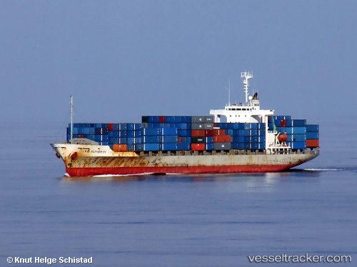
 KAWA KOPER
Current Status
Where is the vessel?
KAWA KOPER is currently in 93 nm W of Sebang, based on AIS data received about 2h ago.
Latest AIS update:
Current position: 6.36833° N, 93.82500° E (93 nm W of Sebang)
Average speed (last 7 days): Loading…
Average speed (last 30 days): Loading…
Vessel profile: KAWA KOPER is a Container Ship with dimensions m x m.
This page combines live AIS, route history, probable destination signals, nearby traffic, and port activity for practical vessel monitoring.
The current position of vessel KAWA KOPER is 6.36833 lat / 93.82500 lng. Updated: 2026-05-14 13:16:26 UTCNearest reference points:
- 80 nm W of Sebang
- 48 nm NW of Sebang
- 160 nm W of Sebang
Currently sailing under the flag of Panama ![]()
Details:
Live Vessel KAWA KOPER Analytics (details, animations, etc.)
Recent AIS points (UTC):
2026-05-14 10:29:18 UTC · 6.33833, 93.28333 · SOG 11 kn · COG -1°2026-05-14 11:43:59 UTC · 6.35333, 93.52667 · SOG 12 kn · COG -1°
2026-05-14 13:01:31 UTC · 6.36667, 93.77833 · SOG 11 kn · COG -1°
2026-05-14 13:16:26 UTC · 6.36833, 93.82500 · SOG 11 kn · COG -1°