 vesseltracker.com
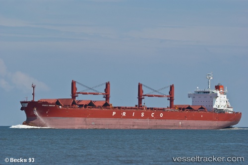
 HOLLY FORWARD
Current Status
Where is the vessel?
HOLLY FORWARD is currently in 27 nm NE of Nanao Pt, based on AIS data received less than 1h ago.
Latest AIS update:
Current position: 23.69855° N, 118.07917° E (27 nm NE of Nanao Pt)
Average speed (last 7 days): Loading…
Average speed (last 30 days): Loading…
Vessel profile: HOLLY FORWARD is a Bulk Carrier with dimensions m x m.
This page combines live AIS, route history, probable destination signals, nearby traffic, and port activity for practical vessel monitoring.
The current position of vessel HOLLY FORWARD is 23.69855 lat / 118.07917 lng. Updated: 2026-05-17 07:56:26 UTCNearest reference points:
- 18 nm SE of Jiuzhen
- 16 nm SE of Jiuzhen
- 23 nm S of Xiamen Pt
Currently sailing under the flag of Panama ![]()
Details:
Live Vessel HOLLY FORWARD Analytics (details, animations, etc.)
Recent AIS points (UTC):
2026-05-17 04:00:15 UTC · 24.20103, 118.72030 · SOG 11.6 kn · COG 231°2026-05-17 04:45:35 UTC · 24.10839, 118.59266 · SOG 11.8 kn · COG 229°
2026-05-17 05:45:05 UTC · 23.97217, 118.43635 · SOG 11.9 kn · COG 232°
2026-05-17 07:56:26 UTC · 23.69855, 118.07917 · SOG 11.2 kn · COG 229°