 vesseltracker.com
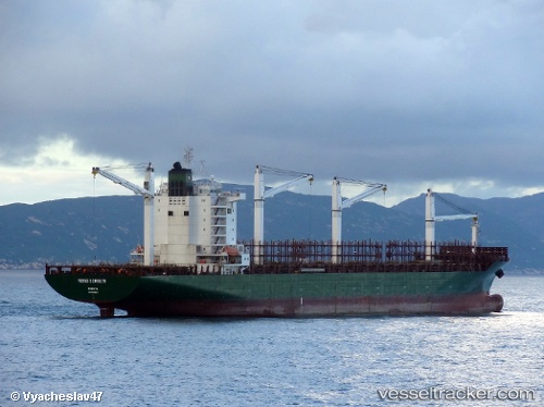
 BHARANI
Current Status
Where is the vessel?
BHARANI is currently in 14 nm W of Tangier, based on AIS data received less than 1h ago.
Latest AIS update:
Current position: 35.78664° N, 6.08692° W (14 nm W of Tangier)
Average speed (last 7 days): Loading…
Average speed (last 30 days): Loading…
Vessel profile: BHARANI is a Container Ship with dimensions m x m.
This page combines live AIS, route history, probable destination signals, nearby traffic, and port activity for practical vessel monitoring.
The current position of vessel BHARANI is 35.78664 lat / -6.08692 lng. Updated: 2026-04-26 05:31:53 UTCNearest reference points:
- Near Gibraltar
- Near Conil de la Frontera
- Near TARIFA
Currently sailing under the flag of Panama ![]()
Details:
Live Vessel BHARANI Analytics (details, animations, etc.)
Recent AIS points (UTC):
2026-04-26 02:36:30 UTC · 36.06148, -5.38929 · SOG 11.2 kn · COG 183°2026-04-26 03:50:55 UTC · 35.94953, -5.63797 · SOG 14.7 kn · COG 268°
2026-04-26 04:17:49 UTC · 35.94260, -5.77933 · SOG 16.1 kn · COG 253°
2026-04-26 05:31:53 UTC · 35.78664, -6.08692 · SOG 13.3 kn · COG 223°