 vesseltracker.com
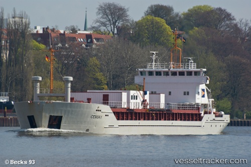
 NACC SKY
Current Status
Where is the vessel?
NACC SKY is currently in 15 nm NE of PORTO PILA, based on AIS data received about 1h ago.
Latest AIS update:
Current position: 45.13909° N, 12.73554° E (15 nm NE of PORTO PILA)
Average speed (last 7 days): Loading…
Average speed (last 30 days): Loading…
Vessel profile: NACC SKY is a Cement Carrier with dimensions m x m.
This page combines live AIS, route history, probable destination signals, nearby traffic, and port activity for practical vessel monitoring.
The current position of vessel NACC SKY is 45.13909 lat / 12.73554 lng. Updated: 2026-04-23 12:20:15 UTCNearest reference points:
- Near Camponogara
- Near PORTO PILA
- Near Murano
Currently sailing under the flag of Panama ![]()
Details:
Live Vessel NACC SKY Analytics (details, animations, etc.)
Recent AIS points (UTC):
2026-04-23 07:47:44 UTC · 45.22375, 12.27376 · SOG 0 kn · COG 187°2026-04-23 09:37:18 UTC · 45.22379, 12.27379 · SOG 0 kn · COG 184°
2026-04-23 10:31:36 UTC · 45.23291, 12.33234 · SOG 9.6 kn · COG 85°
2026-04-23 12:20:15 UTC · 45.13909, 12.73554 · SOG 10 kn · COG 90°