 vesseltracker.com
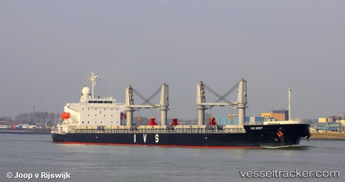
 SAFE COURSE
Current Status
Where is the vessel?
SAFE COURSE is currently in Near Ablogamé, based on AIS data received about 1h ago.
Latest AIS update:
Current position: 6.02102° N, 1.33186° E (Near Ablogamé)
Average speed (last 7 days): Loading…
Average speed (last 30 days): Loading…
Vessel profile: SAFE COURSE is a General Cargo with dimensions m x m.
This page combines live AIS, route history, probable destination signals, nearby traffic, and port activity for practical vessel monitoring.
The current position of vessel SAFE COURSE is 6.02102 lat / 1.33186 lng. Updated: 2026-04-25 19:41:38 UTCNearest reference points:
- Near Ablogamé
- Near Cotonou
- Near Kirikiri
Currently sailing under the flag of Panama ![]()
Details:
Live Vessel SAFE COURSE Analytics (details, animations, etc.)
Recent AIS points (UTC):
2026-04-25 16:24:56 UTC · 6.02000, 1.33167 · SOG 0 kn · COG -1°2026-04-25 17:35:36 UTC · 6.02093, 1.33194 · SOG 0 kn · COG 204°
2026-04-25 19:17:36 UTC · 6.02094, 1.33205 · SOG 0.4 kn · COG 208°
2026-04-25 19:41:38 UTC · 6.02102, 1.33186 · SOG 0.3 kn · COG 204°