 vesseltracker.com
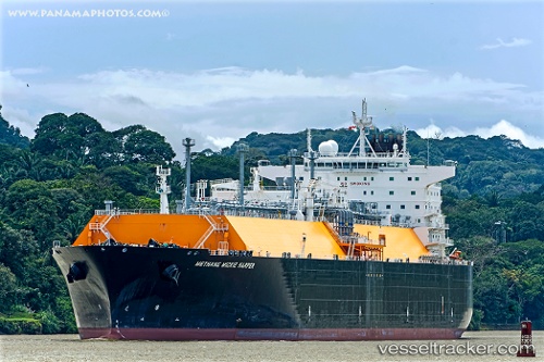
 METHANE MICKIE HARPER
Current Status
Where is the vessel?
METHANE MICKIE HARPER is currently in 251 nm W of Port Clements, based on AIS data received less than 1h ago.
Latest AIS update:
Current position: 53.38066° N, 139.19135° W (251 nm W of Port Clements)
Average speed (last 7 days): Loading…
Average speed (last 30 days): Loading…
Vessel profile: METHANE MICKIE HARPER is a LNG Tanker with dimensions 45m x 290m.
This page combines live AIS, route history, probable destination signals, nearby traffic, and port activity for practical vessel monitoring.
The current position of vessel METHANE MICKIE HARPER is 53.38066 lat / -139.19135 lng. Updated: 2026-05-16 01:20:20 UTCCurrently sailing under the flag of Panama ![]()
METHANE MICKIE HARPER built in 2010 year
Deadweight:
86170 tDetails:
Live Vessel METHANE MICKIE HARPER Analytics (details, animations, etc.)
Recent AIS points (UTC):
2026-05-15 21:29:08 UTC · 53.41000, -139.24167 · SOG 1 kn · COG -1°2026-05-15 22:33:37 UTC · 53.39345, -139.22083 · SOG 1 kn · COG 193°
2026-05-15 23:32:07 UTC · 53.37333, -139.19167 · SOG 1 kn · COG -1°
2026-05-16 01:20:20 UTC · 53.38066, -139.19135 · SOG 1.8 kn · COG 25°