 vesseltracker.com
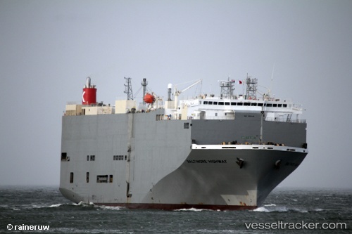
 Baltimore Highway
Current Status
Where is the vessel?
Baltimore Highway is currently in Near Toshima/Tokyo, based on AIS data received less than 1h ago.
Latest AIS update:
Current position: 34.57986° N, 139.22990° E (Near Toshima/Tokyo)
Average speed (last 7 days): Loading…
Average speed (last 30 days): Loading…
Vessel profile: Baltimore Highway is a Vehicles Carrier with dimensions 180m x 32m.
This page combines live AIS, route history, probable destination signals, nearby traffic, and port activity for practical vessel monitoring.
The current position of vessel Baltimore Highway is 34.57986 lat / 139.22990 lng. Updated: 2026-04-27 17:56:49 UTCNearest reference points:
- Near Toshima/Tokyo
- Near Iruma
- 10 nm SE of Iruma
Currently sailing under the flag of Panama ![]()
Baltimore Highway built in 2009 year
Deadweight:
15341 tDetails:
Live Vessel Baltimore Highway Analytics (details, animations, etc.)
Recent AIS points (UTC):
2026-04-27 14:13:13 UTC · 34.42667, 138.13419 · SOG 16 kn · COG 94°2026-04-27 15:48:52 UTC · 34.40902, 138.62526 · SOG 15 kn · COG 87°
2026-04-27 16:02:50 UTC · 34.41385, 138.69579 · SOG 15.2 kn · COG 85°
2026-04-27 17:56:49 UTC · 34.57986, 139.22990 · SOG 16.6 kn · COG 60°